
Bradford on Avon Walking Wheel
A 46 mile network of inter-connected walks.
“Just to say many thanks for the Bradford Wheel. We think it is a great idea and very useful for locals such as ourselves and visitors to the area … many thanks and well done for producing such a great asset to the area.”
Scroll down to the bottom of the page for links to the entire Walking Wheel on OS Maps.

BoA Walking Wheel Revision 8 August 2022
The Inner Circuit of the Walking Wheel has now been expanded from 5.8 to 6.5 miles, to incorporate the new developments on the Holt Road, east of the town. This will be shown on the latest batch of Wheel Maps “Rev 8 August 2022”.

The Outer Circuit of The Walking Wheel was expanded in January 2022 by 3 miles to 25 miles. This is to accommodate the village of Atworth, North of Bradford on Avon, which is now a member village of the BoA Community Area.
A fresh batch of Wheel maps, “Rev 7 - December 2021” - showing this new extension has arrived and is currently available in Ex Libris and the Town Library.
The new route will head North from Great Chalfield Manor, skirt Broughton Gifford and enter Atworth near the Clock Tower. It then passes through Stonar School and rejoins the existing Outer Circuit at Wraxall Manor.
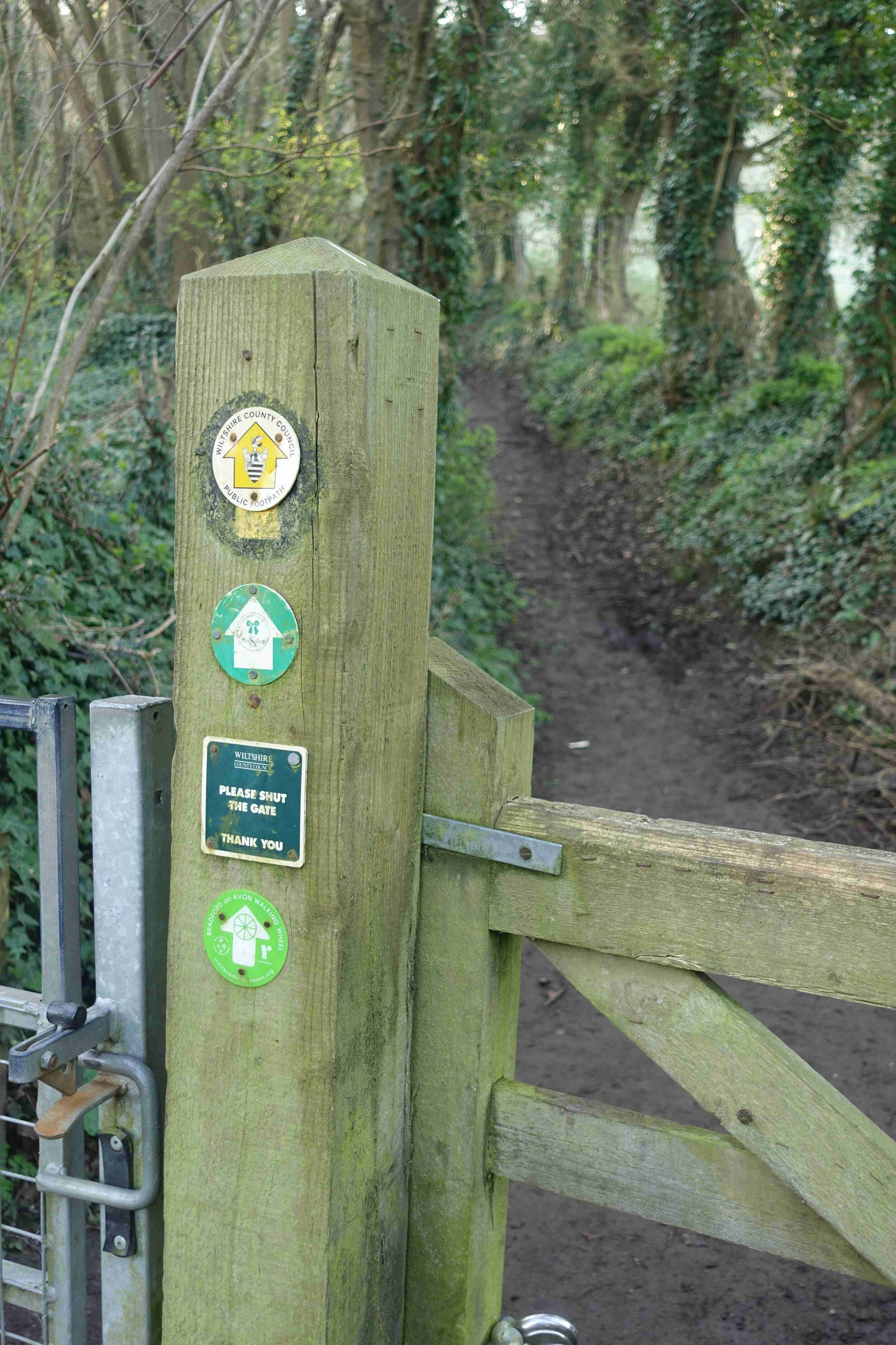
The green waymarkers on the previous route from Great Chalfield Manor through to South Wraxall will remain in place for the time being for those people using the earlier versions of the map.
A pocket sized, large scale, laminated map of the entire Wheel network can be bought locally @ £6 from ExLibris Bookshop in The Shambles, £5 in the Town Library and £6 from Explore BoA.

The Bradford on Avon Walking Wheel is an innovative collaboration between Bradford on Avon Walkers are Welcome, West Wiltshire Ramblers and the Bradford on Avon Area Board (Wiltshire Council).
The Wheel was installed in 2016. It is being regularly used by walkers and runners and many people, from the UK and abroad, are visiting the area attracted by The Wheel. It has been extended twice in 2022 to incorporate local changes.
The 46 mile waymarked network of walking routes inter-connects Bradford on Avon and the nine satellite villages of Atworth, Holt, Limpley Stoke, Monkton Farleigh, South Wraxall, Staverton, Westwood, Wingfield and Winsley. It offers countless walking opportunities.
To help you find your way and remain on the route we recommend you always take The Wheel map with you in case a waymarker is missing.
The routes are on rights of way footpaths, quiet country lanes, the canal towpath and a few, short sections of road.
They pass through a wonderful variety of terrain, offering great views and superb walking experiences.
There are many local attractions en route including National Trust properties, canal aqueducts, pubs and cafes.
The maps have been produced for us by the really popular Yellow Publications company based in Cornwall. We have sold almost 2,000 copies.
The Walking Wheel is featured on the Long Distance Walkers Association website.
The whole Wheel can be used on your smartphone using OS Maps. You can download the routes from the section below.
Green waymarkers Orange waymarkers Blue waymarkers
25 mile Outer Circle 6.5 mile Inner Circle 14 miles of connecting spokes


The Bradford on Avon Walking Wheel on OS Maps

Click on the maps to take you through to the link


“Hi BoA wheel organisers,
thank you so much for making and signing the Wheel. It’s brilliant. I went for a run on the canal from Trowbridge last weekend and saw the little green sign tempting me off the canal path. I ended up running the outer route (so I got back home about 5 hours later than I was supposed to). It’s got a bit of everything and lots of views I hadn’t seen before, awesome. Thank you. And thanks too for the great signage which made it so so much easier, especially by the end when I was getting tired. I’m organising a group run of it soon too, for a bit of fun. Anyway, main thing is thank you! top work:-)
— Email from a local runner